Spatial Analysis and Map Design
Mapping Farm-Level Agricultural Census Data
Most farmers rarely wrote down how they ran their farm or why they did things this way rather than another – and even more rarely did their records survive. But I wanted to know more about agricultural knowledge. Mapping farm data broadened the picture beyond the fragmentary historical record.

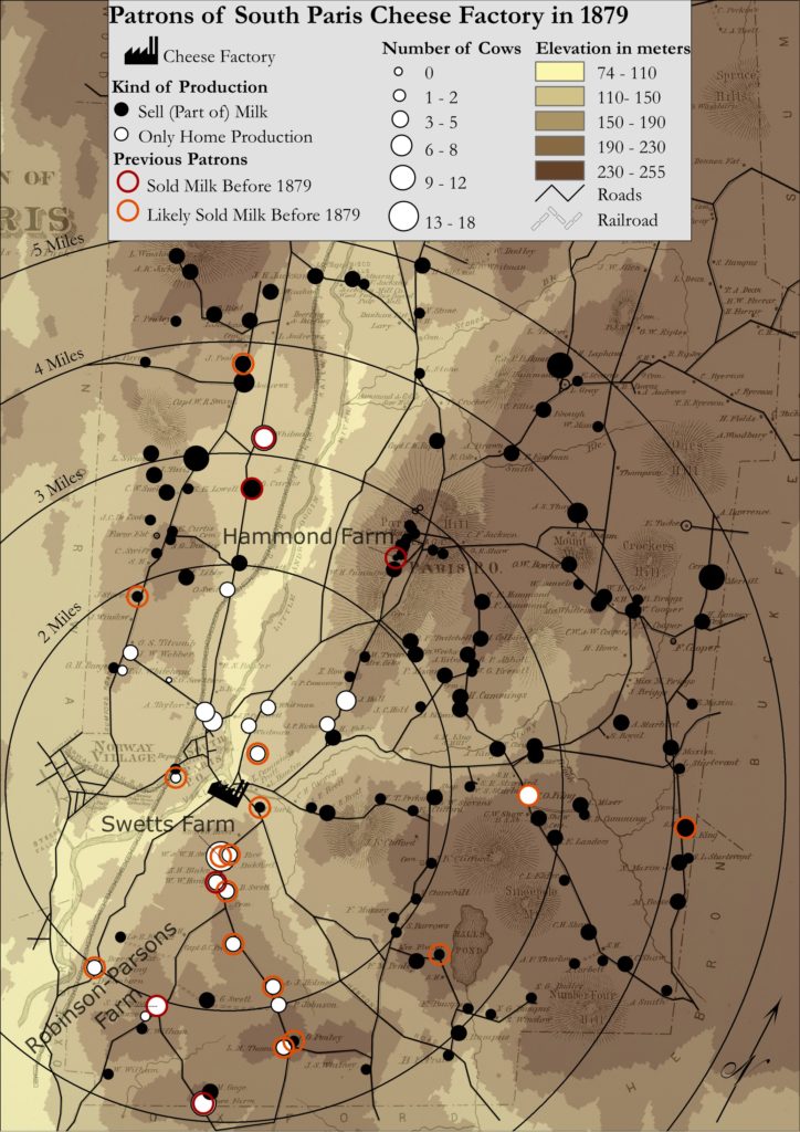
This map investigates the relationship of farms and the cheese factory in the small town of South Paris, Maine. I wanted to know which factors may have influenced farm people to participate in the industrialized processing of dairy products and the growing regional market attached to it. I combined an 1880 county atlas map with elevation data, matched the noted farms on the map with manuscript agricultural census data, and researched personal notes and published reports of South Paris farmers to provide more context. I could prove empirically that proximity, the number of cows on the farm, and neighborhood relationships – more so than elevation – made it easier to sell milk to the cheese factory, but the decision remained an individual one. These micro-historical findings then informed my larger argument.
Census data is rarely mapped on a farm or household level, but this time-intensive task can reveal so much about actors often written out of history.
